You are on the Gravelroots Rother Valley Trail - page 13_2 - Fittleworth, West Sussex, UK
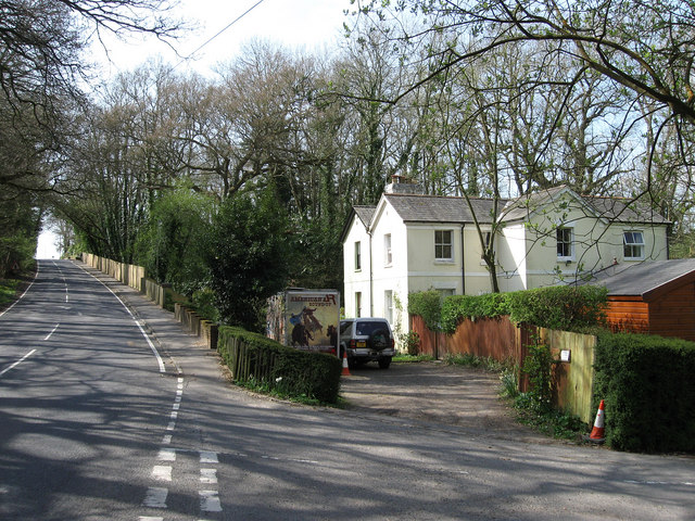 |
| Coming in to Fittleworth on the B2138, Tripp Hill.- looking back to south.
Station Masters House to right, served the nearby station which operated between 1889-1955. The road on the right leads to the old station - Fittleworth Bridge behind photographer. photo - Simon Carey - 5 April, 2009 - - next trail image |
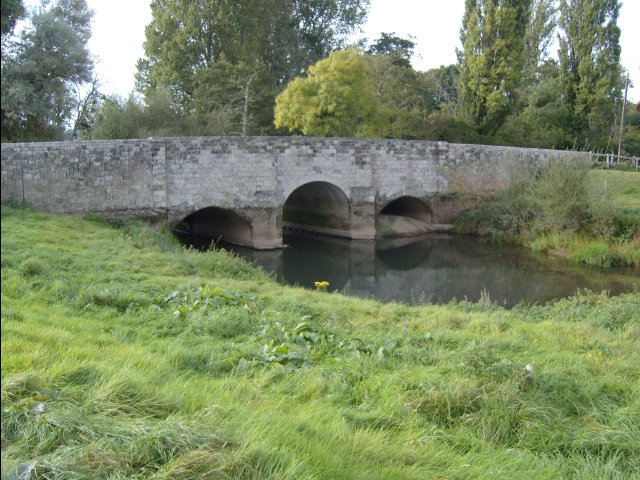 |
| Fittleworth Bridge over the Rother looking west, upstream. Fittleworth to right.
Navigable from the Arun at Stopham to Midhurst from 1794 to 1888 and closing to all trade in 1936 The centre arch was enlarged to accomodate commercial barges. photo - Hugh Neve - Sep.2007 - - next trail image |
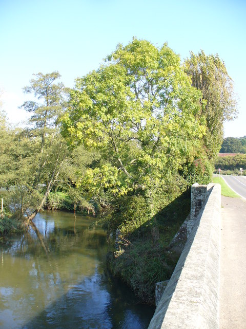 |
The Rother with Millstream just visible to right.
photo from bridge looking north, B2138 right, Lower Fittleworth Seen from the Bridge, the mill stream joins the western Rother immediately upstream of the bridge. The mill is now residential and is hidden by the trees. photo - Colin Smith 26 September, 2008 next trail image |
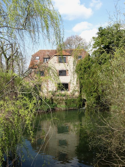 | Fittleworth Watermill
Viewed from the mill bridge this structure was built in the 1780s and stopped working in the early 20th century. Now a private residence. photo - Simon Carey 5 April, 2009 next trail image |
You are heading north on the B2138 at Fittleworth, West Sussex, UK - on the Gravelroots Rother Valley Trail - page ref 13_2
|
Gravelroots is a locally operated website based at Heyshott in the Rother valley, West Sussex, England.
If you came to these pages looking for specific information and were unable to find it, please let us know. |
If you have photos, documents or information you wish to submit why not e-mail copies to us & share them with everyone.
|
Part of the Rother Valley Guide by Gravelroots
Searching for something specific, use the indexes This site is best viewed in 1024 x 768 using Internet Explorer |
copyright information